Mount Latimojong – South Sulawesi

Mount Latimojong
Indonesia 7 Summits
Elevation :
3478m (11,411 ft)
Difficulty :
Intermediate
Duration :
4 Days
Location :
South Sulawesi, Indonesia
Mount Latimojong “The Summit of Sulawesi”, with its highest peak known as Rante Mario, is the tallest mountain on the island of Sulawesi, Indonesia. Rising to an elevation of 3,478 meters (11,411 feet), it represents the island’s highest point and is one of the seven peaks that make up the prestigious Indonesia Seven Summits challenge. Located in the Enrekang Regency of South Sulawesi, Mount Latimojong is part of a remote and rugged mountain range that stretches across the island’s interior. The area is largely untouched by mass tourism, offering a pristine and tranquil environment ideal for nature lovers and adventure seekers. The climb to Rante Mario is not only a physical challenge but also a journey through one of Sulawesi’s most biodiverse regions.
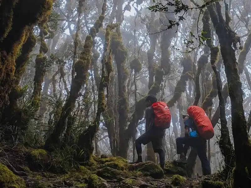
The trek to the summit typically begins in the village of Karangan and takes about five to seven days round-trip. Along the way, hikers pass through dense tropical rainforests, mossy cloud forests, and alpine meadows. The trail is rich in flora and fauna, with endemic bird species and unique plant life rarely seen elsewhere in Indonesia.
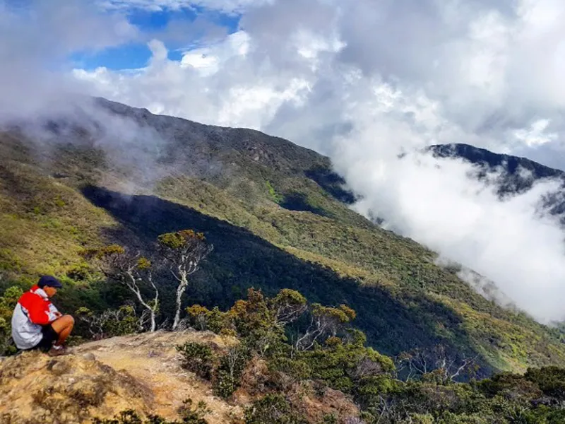
Unlike the more popular volcanic peaks of Java or Lombok, Latimojong’s appeal lies in its remoteness and natural serenity. The mountain is not volcanic, which makes the terrain more stable, though the steep and slippery paths still demand a good level of fitness and preparedness.
For the local communities, the mountain holds cultural and spiritual significance. It is often associated with ancestral spirits and traditional beliefs that emphasize respect for nature.
Climbing Mount Latimojong is a rewarding experience for those seeking solitude, stunning natural beauty, and a deep connection with Indonesia’s wild heart. As the roof of Sulawesi, it stands as a proud symbol of the island’s rugged and majestic character.
Hiking Trail
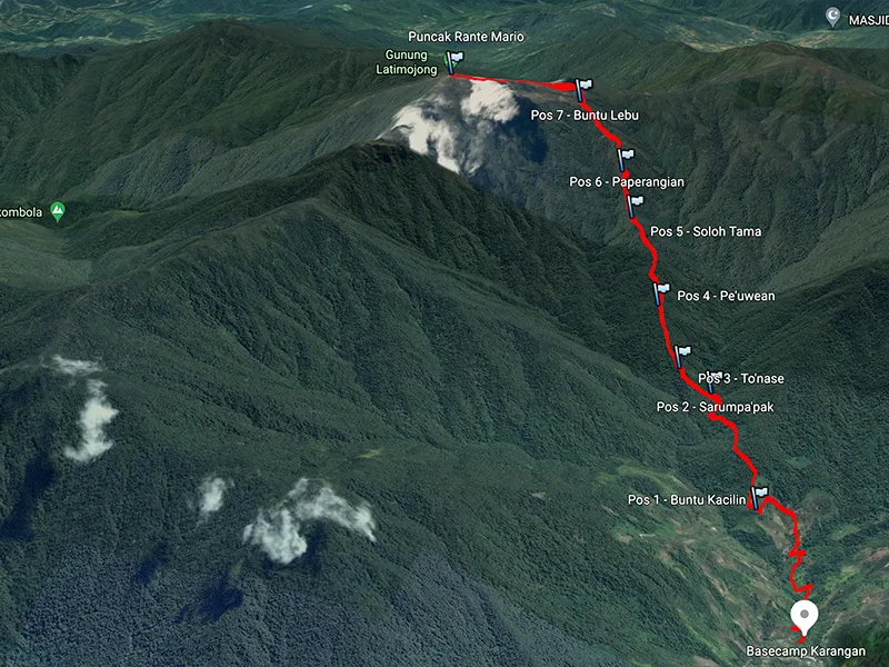
The common climbing route used to reach the peak of Rante Mario is from Baraka District, the following are the climbing stages that will be passed starting from Baraka District:
1. Baraka Stage – Latimojong Village (Lemo Chain)
From Baraka you can take a jeep to Latimojong village or also known as Rante Lemo village. Generally this jeep only goes as far as Latimojong village but sometimes during the dry season it can also go as far as Karangan village.
2. Latimojong Village – Karuaja Village
After walking from Latimojong Village for approximately 1 hour 15 minutes, the path will pass through Karuaja Village, a small village located in a hill valley.
3. Karuaja Village – Karangan Village
From Karuaja village, the journey continues towards Karangan village which still has to be reached for 2 hours on foot, in the middle of the journey to Karangan village we will find another small hamlet called Buntulamba. Karangan village is located on the edge of a hill with an altitude of 1,390 m above sea level, and is crossed by a fairly large river with clear water, namely the Salu Karangan river. In this hamlet, climbers can stay at the village head’s house and if you need a porter, you can find one here.
4. Karangan Village – Post I (Buntu Kaciling)
The hiking trail from Karangan village to Post I begins by following the current of the Salu Karangan river, then crossing a bridge made of tree trunks and climbing up with a slope of approximately 50 – 70 degrees. Shortly afterward we will meet a two-way road, namely to the left horizontally is the hiking route to the peak of Rante Mario and straight up is the hiking route to the peak of Nenemori which is the second highest peak in the Latimojong mountains. The hiking trail to Post I is often found with forks in the road which are the trail routes of hunters and loggers. Post I is called Buntu Kaciling and is located at an altitude of 1,800 m above sea level, and is an open area measuring 4 square meters. There is no water source at this post.
5. Post I (Buntu Kaciling) – Post II (Goa Sarung Pakpak)
The hiking trail to Post II or also known as Goa Sarung Pakpak Post from Post I will vary, climbing and descending and skirting the edge of the cliff. When approaching the Post II area, the route will descend because Post II is located under a rock cliff. The plains at Post II are not too large, the water source is abundant because at Post II a fairly fast flowing river flows which is part of the Salu Karangan river. This post is at an altitude of 1,800 m above sea level. The travel time from Post I to Post II is 1 hour 45 minutes. At this post, climbers usually spend the night, but if you leave very early in the morning from Karangan, it is better to stay at Post V.
6. Post II (Wing Gloves Cave) – Post III (Lantang Nase)
Leaving Post II, a steep uphill terrain will be faced, with a slope of about 80 degrees and this will be taken continuously for 1 hour of travel. This dangerous climb has no flat bonus at all and is very dangerous if careless with balance can fall backwards. Post III known as Lantang Nase is a flat area measuring five square meters and there is no water source here. Located at an altitude of 1,940 m above sea level.
7. Post III (Lantang Nase) – Post IV (Buntu Lebu)
The climbing route to Post IV, called Buntu Lebu from Post III has a slope of 60 to 70 degrees, with the occasional bonus of a flat road. Post IV is at an altitude of 2,140 m above sea level and is a flat area measuring six square meters. Covered by trees and has no water source. Travel time from Post III to Post IV is approximately 45 minutes.
8. Post IV (Buntu Lebu) – Post V (Soloh Tama)
Soloh Tama is the name of Post V, which is a large flat area and can accommodate at least 10 tents, slightly open and located on the side of a ridge with an altitude of 2,480 m above sea level. The travel time from the previous post to this post is 1 hour 30 minutes. At this Soloh Tama Post there is a water source in the form of a river which is approximately 100 meters down towards the valley on the left of the path if we go towards the peak. This post is often used as a place to spend the night by climbers.
9. Post V (Soloh Tama) – Post VI
The travel time from Post V to Post VI is about 40 minutes. Post VI is at an altitude of 2,690 m above sea level. There is nothing special about this post, it is only three by six meters in size, but from this location we can already see the Latimojong mountain range and from here we can also see Buntu Dea from a distance. There is no water source at this location.
10. Pos VI – Pos VII (Kolong Buntu)
The hiking trip from Post VI to Post Kolong Buntu or Post VII takes about 1 hour 30 minutes. The hiking trail to Post VII is already open and from the trail we can enjoy the expanse of the Latimojong mountains. Post VII itself is an open flat land without trees, located at an altitude of 3,100 m above sea level. At the location of Post Kolong Buntu, we can spread the open view to all corners, and the bluish green Latimojong mountains make it cool to look at. At this post there is a water source in the form of a small clear river flow which is on the left side of this post if we face the peak, under the flow of the small river the water is collected in a pool-shaped recess. This small river is approximately 15 meters from the location of the post VII camp.
11. Post VII (Kolong Buntu) – Pertigaan
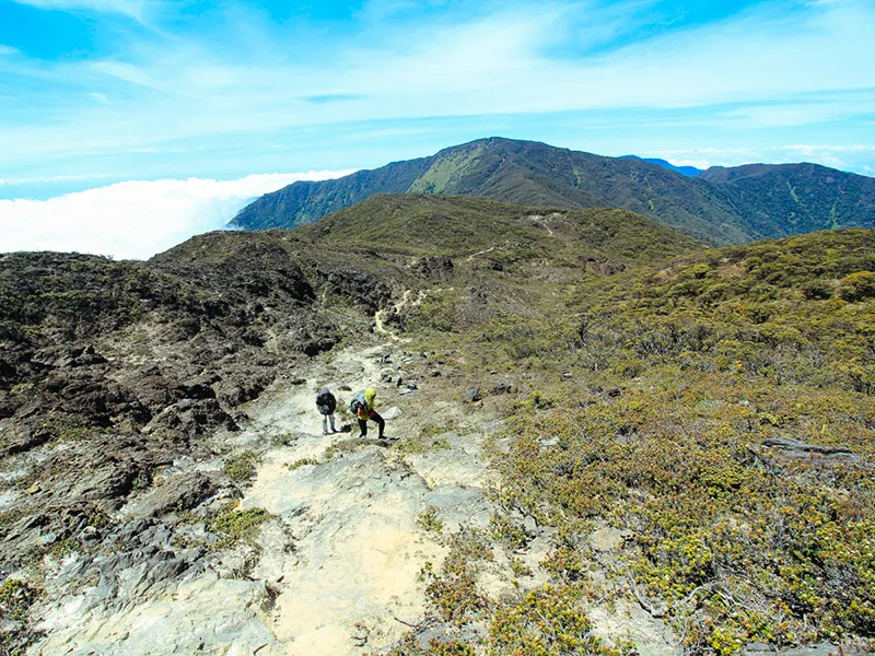
Pertigaan is a fairly large open area, when you arrive at this area the hiking trail branches into two, to the left is the hiking trail to the peak of Rante Mario and a 30° turn to the right is the hiking trail that will lead us to the peak of Nene Mori and if you turn 90° to the right is the path down towards Palopo. Before entering this intersection area, we will meet a forked road, namely to the right to the peak of a ridge with an antenna (an unused ABRI communication antenna), and to the left towards the Intersection. The travel time required to reach this intersection area from Post VII is around 20 minutes, and this Intersection is at an altitude of 3,300 m above sea level. There are no water sources at this location.
12. Pertigaan – Rante Mario Peak
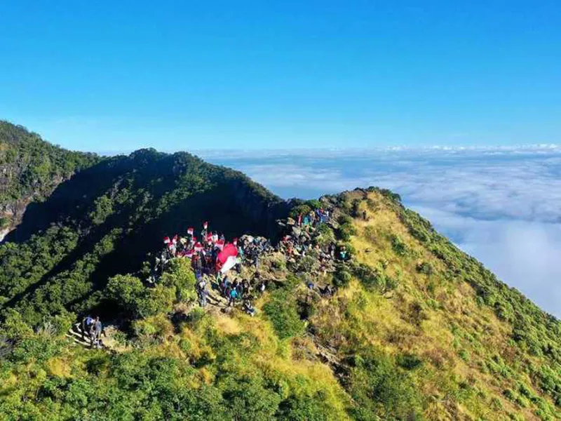
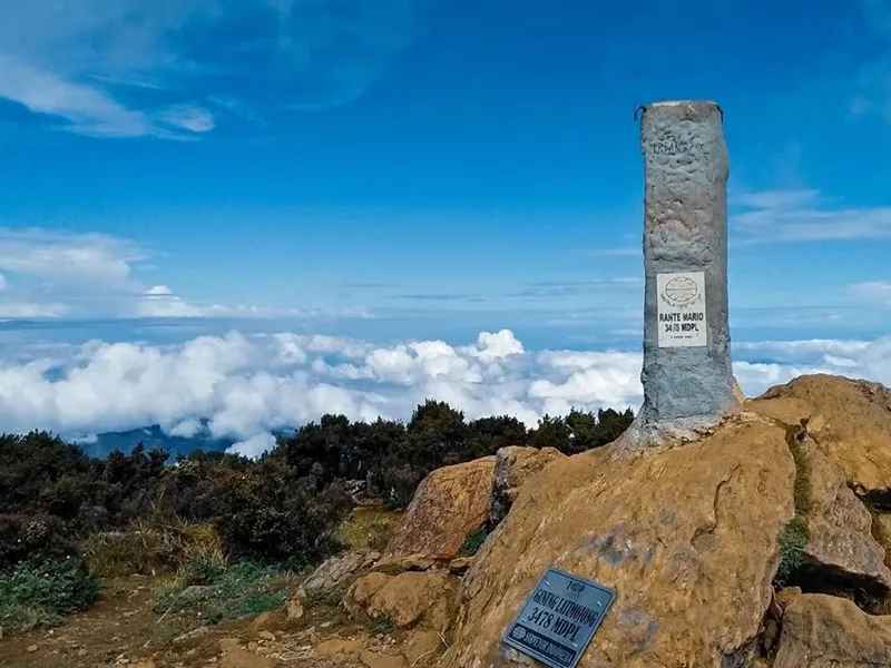
To reach the peak of Rante Mario from Pertigaan, the climbing path is slightly flat with occasional uphill slopes of approximately thirty degrees. Passing through open rocky terrain, there are two paths but both paths eventually meet and become one before reaching the peak area. From the peak of Rante Mario, the view can be spread to all directions, to the north you can see the peak of Buntu Rantekombala, to the west stands the peak of Pantealoan and a row of hills in Buntu Dea, while to the south there is the peak of Buntu Nene Mori. The peak of Rante Mario is very wide, and there is a pole indicating its height.
Indonesia Seven Summits