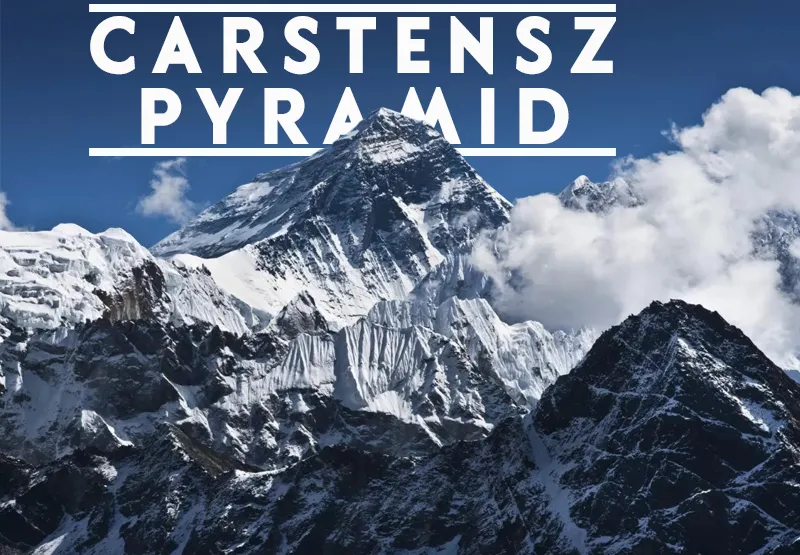
Mount Carstensz Pyramid – Puncak Jaya
Mount Carstensz Pyramid
World 7 Summits
Elevation :
4884m (16,024 ft)
Difficulty :
Intermediate
Duration :
11 Days
Location :
Papua, Indonesia
Mount Carstensz Pyramid or also known as Puncak Jaya, is the highest mountain in Indonesia with an extreme climbing route with an elevation of 4,884 m (16,024 ft). Carstensz Pyramid is included in the World Seven Summits and is the main attraction for climbers because its peak is always covered in snow.
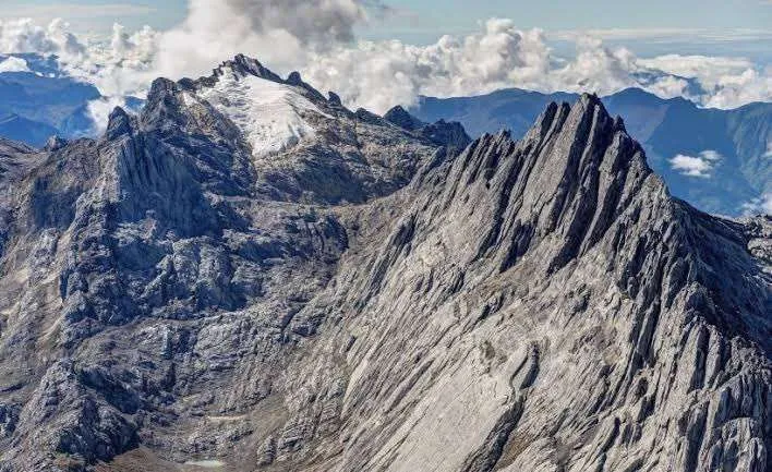
Carstensz Pyramid (Puncak Jaya), Jayawijaya Range, Papua is a unique karst mountain range in the world and is one of five places on the equator covered in snow. Carstensz Pyramid is a karst mountain location that has an important meaning for Indonesia and the world. Based on data in 1992, snow in Cartenz Pyramid (Puncak Jaya) reached an area of 3,300 hectare.
The Jayawijaya and Sudirman Ranges were formed by the collision of the Australian and Pacific plates. These ranges have a number of peaks, namely Puncak Carstensz Timur (4400 m), Puncak Yamin (4535 m), Puncak Idenberg (4673 m), Puncak Trikora (4730 m), Puncak Mandala (4760 m), and Carstensz Pyramid or Puncak Jaya (4884 m).
History of Carstensz Pyramid
The name “Carstensz” comes from a Dutch sailor named Jan Carstenszoon. Jan Carstensz first saw this mountain in 1623 while sailing on the southern coast of Papua. During his voyage, he saw through his telescope a snow-covered mountain peak. Jan Carstensz reported his findings to Europe and they found it hard to believe that there was snow in a tropical area close to the equator. Jan Carstensz’s report proved correct, the snowy peak he saw is now known as Carstensz Pyramid (Carstensz Peak) or Puncak Jaya.
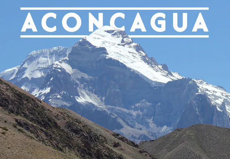
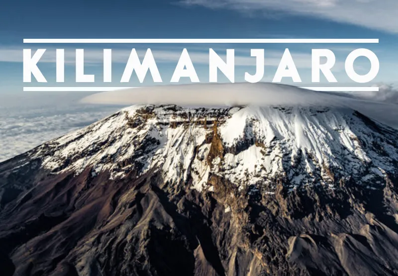
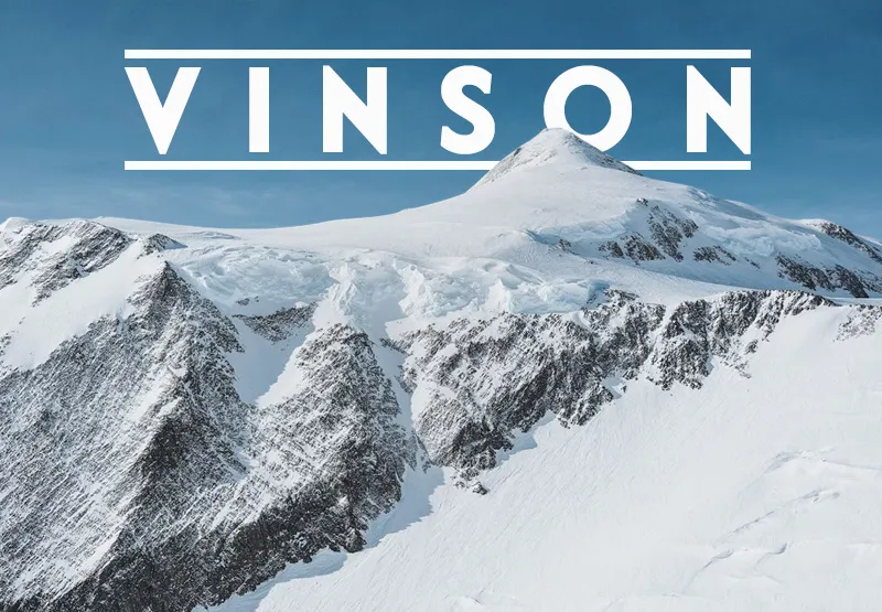
Mount Carstensz Pyramid is a favorite destination for world climbers because it is included in the World’s Seven Summits which represent the continent of Oceania. The “Seven Summits” refers to the highest peak on each of the seven continents: Mount Everest (Asia), Aconcagua (South America), Denali (North America), Kilimanjaro (Africa), Mount Elbrus (Europe), Mount Vinson (Antarctica), and Carstensz Pyramid (Oceania).
In 1962 the first person to reach the summit of Carstensz Pyramid was Heinrich Harrer from Austria on his expedition with three other expedition members, Robert Philip Temple, Russell Kippax, and Albertus Huizenga. Philip Temple from New Zealand, had previously led an expedition to the area and pioneered the access route to the mountain.
Puncak Jaya has tropical glaciers that are attractions, Meren Glacier, Carstensz Glacier and Northwall Firn. One of three tropical glaciers in the world, other tropical glaciers are in the Andes region of South America, namely Peru and Ecuador, and in the East African region, namely Mount Kenya, Mount Kilimanjaro, and Ruwenzori.
Carstensz Pyramid Travel Route and Hiking Trail
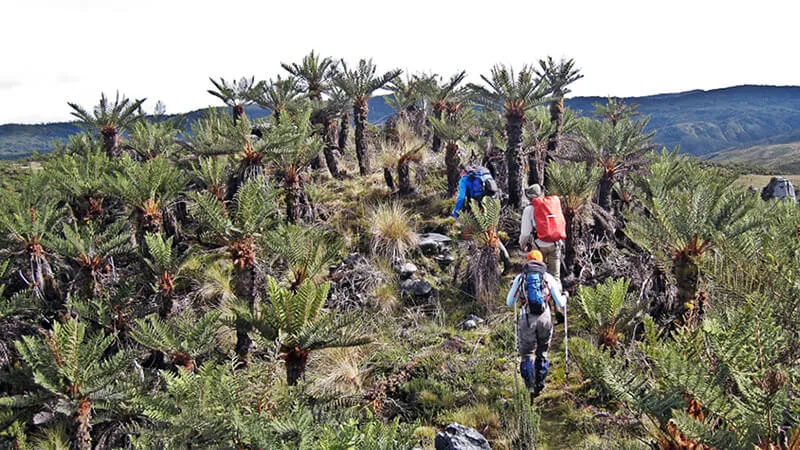
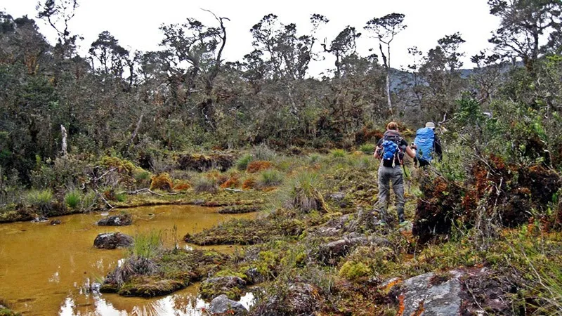
The Carstensz Pyramid hiking trail is known to be challenging, with unpredictable weather. The hiking trail to Carstensz Pyramid usually starts from Ilaga and Sugapa Villages. However, each trail has its own challenges, so climbers need to prepare themselves thoroughly and to climb it requires rock climbing skills.
1. Travel Route via Freeport Indonesia
The journey to Carstensz through the mining area of Freeport Indonesia, Ltd is very fast and only takes a few hours. From Timika to Tembagapura and Grasberg and continue to Bali Dump which is the final boundary of Freeport Indonesia’s territory. Finally, walk for approximately two hours from Bali Dump to reach the Danau-Danau Basecamp.
However, this route is risky for health, Timika’s altitude is only a few hundred meters above sea level while the Danau-Danau Basecamp is at an altitude of 4261 m. Sudden changes in altitude can trigger Accute Mountain Sickness (AMS). Climbers are advised to acclimatize by traveling gradually.
2. Travel Route via Sugapa
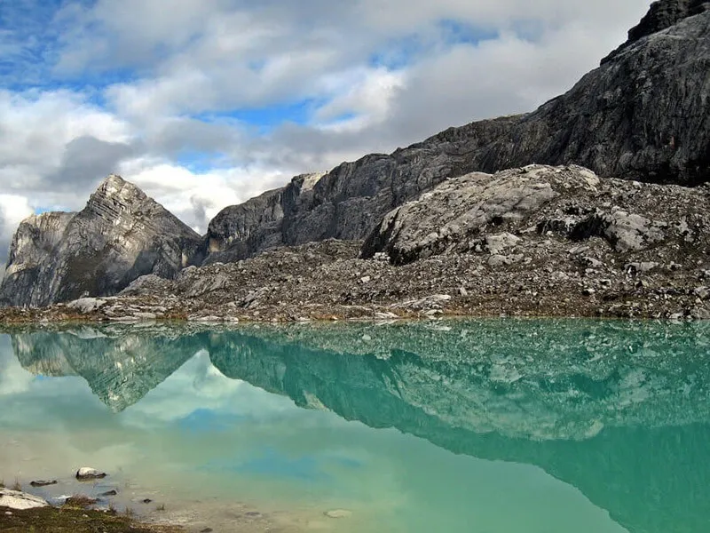
The journey to Carstensz via Sugapa will take days. It is less risky because the elevation changes are gradual, but it costs more. However, this will certainly be paid off by the beautiful scenery and wilderness adventures that can be enjoyed during the journey. This area is surrounded by the Bula Pigu, Mbulu-Bulu Pigu, and Jogo Pigu Mountains. There are also two valleys, namely the Dugindoga Valley and the Kemadoga Valley. In addition, there are hot springs, salt rivers, and rivers that can be used for rafting such as the Wabu and Dogabu Rivers.
To climb Carstensz via Sugapa, explorers need to travel to Timika or Nabire. Continue by using a pioneer plane to Bilogai Airport, Sugapa District. After that, explorers can choose to continue the journey via Ugimba or Soagama.
– Puncak Jaya via Ugimba
Puncak Jaya is located in Ugimba District, Intan Jaya Regency. The journey to Ugimba from Sugapa is not easy. It takes hours of walking up and down hills and down valleys crossed by the fast-flowing Kemabu River. From there, the journey continues until you arrive at New Zealand Pass. After that, it takes half a day from New Zealand Pass to reach the Danau-Danau Basecamp.
– Puncak Jaya via Soagama
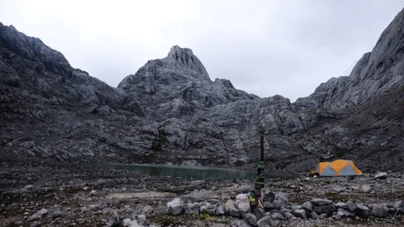
From Sugapa walk to Soagama Village in Hitadipa District. From Soagama the journey continues to Camp Zambusiga which is located at an altitude of 2181 m then Camp Inda Tsiga (3222 m), Ebay Camp (3580 m), Nasidome Camp (3726 m), New Zealand Pass, and finally Basecamp Danau-Danau (4261 m).
3. Travel Route via Ilaga
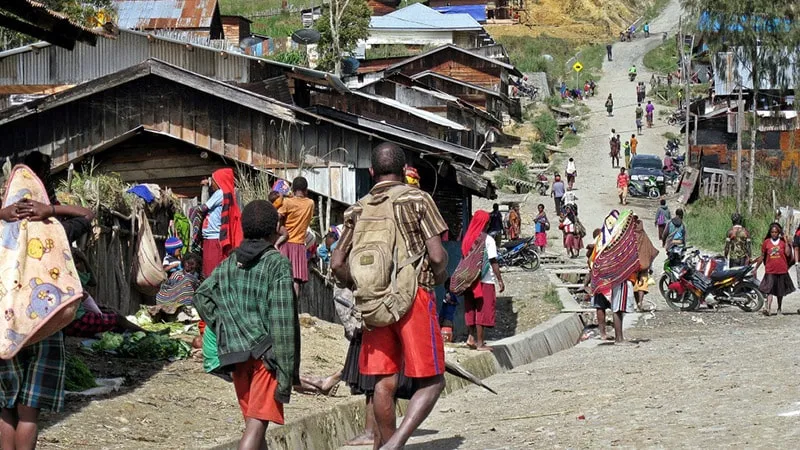
The second gateway to Carstensz is Ilaga Village, located at an altitude of 2286 m making it the highest district in Indonesia. To reach it, explorers need to take a small plane from Timika or Nabire to Ilaga Airport for 25 minutes. The number of flights to Ilaga usually reaches at least 20 times per day, depending on weather conditions and fleet availability.
From Ilaga, continue walking through Pinapa Village then through the forest to then arrive at Larson Lake, Blue Lake, New Zealand Pass, and finally arrive at the Lakes Basecamp. The total journey is estimated to take six days from Ilaga.
4. Travel Route If Using a Helicopter
This last option is the easiest because the permits are not as complicated as the Freeport route and you don’t have to walk for days through the dense Papuan forest like on the Sugapa or Ilaga routes. However, this option is still rarely used because it is very expensive. From Enarotali or Timika City, use a helicopter to then land at Yellow Valley, an area located after the Danau-Danau Basecamp
At the Danau-Danau Basecamp, climbers usually stay for a while to acclimatize or adjust their body condition to the altitude for several days. From the Danau-Danau Basecamp, climbers head towards Yellow Valley. Normally, climbing from Lembah Kuning to the summit takes about eight hours round trip. However, natural conditions are unpredictable.
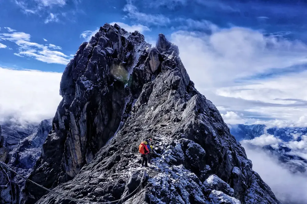
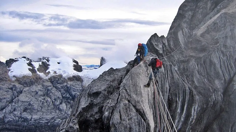
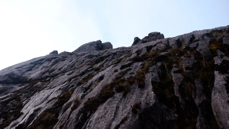
After Lembah Kuning, climbers will pass through a place called terraces 1, 2, and 3, then Teras Besar. This location is called Teras Besar because it has a fairly large open area. After that, continue by climbing the vertical cliff to Summit Ridge.
Then the climb continues by crossing a ravine that needs to be crossed with the Tyrolean technique along 20 meters. Continued with two more gaps of 5-10 meters wide, after that the Explorers reach the Peak of Carstensz Pyramid.
World’s Seven Summits